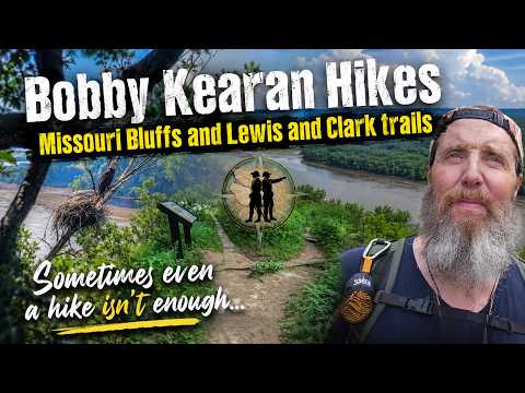
Missouri Bluffs & Lewis and Clark Trail β€” Eagles, Egrets, Lost Mic, and an Uncooperative Day.

Some days the trail gives you everything. Some days it gives you an air show traffic jam, a dead GPS, a missing hiking stick, and a lapel mic that decided to bail.

This was one of those days. And somehow, it still delivered.

πŸ“ Missouri Bluffs Trail β€” Weldon Spring, MO

πŸ“ Lewis and Clark Trail β€” Weldon Spring, MO

I missed a turn on the way to Missouri Bluffs and ended up crossing the Daniel Boone Bridge into St. Charles β€” right into the middle of Blue Angels air show traffic. First exit backed up for miles. Second exit barely better. I went 7.5 miles out of my way (and back) just to get to the trailhead.

Already forgot my GPS phone in the car. Garmin was dead. Hiking stick still at home. Forgot the picaridin. Classic. BUT β€” worth it.

πŸ¦… Found the eagle nest on the island below the bluffs. Both parents were present and two eaglets, nearly ready to fledge. And here’s the thing I didn’t expect β€” that same island has a rookery tree covered in Great Egret and Cormorant nests. An entire bird apartment complex out there. Wild.

Then I lost my lapel mic mid-hike. I had the magnet backwards, and that gave out somewhere on the trail. What followed was essentially a game of Marco Polo with myself β€” recording a clip, checking if the audio was closer or further, moving, repeating. Found it. The whole process is in the blooper reel at the end. You’re welcome.

On to Lewis and Clark Trail, just down the river. Hiking was fine. Videos were not β€” at least not at first. More importantly, that feeling β€” that moment where the trail takes over and the noise of everything else just fades β€” it didn’t really show up today. Sometimes it does. Sometimes it doesn’t. That’s honest.

What I didn’t expect was Dave. Older gentleman, two hip replacements, absolutely outhiking me, and just a genuinely good person to talk to on a trail. Didn’t know I needed that. Turns out I did.

Sometimes even a hike isn’t enough. But it’s still worth going. —

πŸ›’ BOBBY KEARAN HIKES STORE Support the channel with stickers and shirts and other stuff: πŸ‘‰ https://shop.bobbykearan.com/hhgh/

Save and grow your money for those Thru Hikes you are planning with Acorns: https://acorns.com/share/?shareable_code=GCYFNCF&first_name=Bobby&friend_reward=5

🎡 MUSIC Intro & outro music written by me and performed by AI, because I can’t sing. You are welcome.

Full tracks available on Bandcamp: πŸ‘‰ https://bobbykearanhikes.bandcamp.com

— #MissouriHiking #MissouriBluffs #LewisAndClarkTrail #WeldonSpring #BaldEagle #Eaglets #GreatEgret #Cormorant #BlueAngels #TrailLife #HikingMissouri #BobbyKearanHikes #HikeHangGetHigh #MidwestHiking #HikingFails #NatureWalk #BirdWatching #GetOutside #MissouriTrails

Similar Posts

  • Little Lost Creek Conservation Area | Creek Crossings, & a Steep Loop | Missouri Hiking

    This one’s got a little bit of everything. Little Lost Creek Conservation
    Area, out of the North Hwy B Trailhead, packs flat road walking, meadow
    trail, deep woods, rocky hills, and a creek bed all into one loop.

    Started out of the parking lot on an old dirt road still in use today.
    About .35 miles in, the route splits off onto a horse trail that skirts
    around some private property before reconnecting with the old road. From
    there it drops into the loop portion β€” old road gives way to a wide grass
    path along the ridge. About 2.12 miles in, a little ways down the first
    big, steep, rocky downhill, there’s a genuinely great view out over the
    surrounding wooded hills. From there it’s the rest of the way down to the
    creek, crossed twice, then a big, steep climb back up the other side. That
    second hill had my full attention β€” didn’t get much chance to look around
    β€” but it earned a lunch break at the top before leveling out into a
    beautiful field road lined with cedar and oak, all the way back to the
    loop junction and out to the parking lot.

    πŸ“ Trail Info:
    – Trail: Little Lost Creek Conservation Area Loop
    – Trailhead: North Hwy B Trailhead
    – Distance: 5.47 miles
    – Time: 3 hours 55 minutes
    – Elevation Gain: +417 ft
    – Difficulty: Moderate to Challenging (Hilly)
    – Highlights: Ridgeline overlook (~2.12 mi), double creek crossing,
    steep climb out, cedar and oak field road, mix of terrain types

    ⏱️ Chapters:
    0:00 Trailhead – North Hwy B Parking Lot
    0:14 Horse Trail Split (~0.35 mi)
    1:13:52 Ridgeline Overlook (~2.12 mi)
    1:57:43 First Creek Crossing
    2:00:27 Second Creek Crossing
    2:02:56 Steep Climb Begins
    2:20:25 Ridge Field Road – Cedar & Oak
    2:25:00 Lunch Break
    3:14:00 Back on the Trail
    3:25:29 Back Near Loop Junction
    3:54:44 Trailhead – Loop Complete

    πŸ—ΊοΈ Stick around to the end for a first look at our new Trail Player 3D β€”
    a 3D fly-through of the route with color-coded difficulty along the way.
    Still rolling this out, and this trail’s a great one to show it off on.

    πŸ₯Ύ Bobby Kearan Hikes β€” Hike, Hang, Get High. Missouri trails, the Ozarks,
    and Mark Twain National Forest. Subscribe for more Missouri hiking content!

    πŸ›’ Check out the store: https://shop.bobbykearan.com/hhgh/
    πŸ’° Get $5 free with Acorns: acorns.com/share/?shareable_code=GCYFNCF&first_name=Bobby&friend_reward=5

    🎡 Music written by me, performed by AI because I can’t sing. You are welcome.
    https://bobbykearanhikes.bandcamp.com

    #MissouriHiking #LittleLostCreek #HikeHangGetHigh #MDCConservationArea #Ozarks

Leave a Reply

Your email address will not be published. Required fields are marked *