Blog Posts

  • Saint Stainislaus Conservation Area | Missouri Hiking | The Hills are Unexpected

    The hiking apps I used to try to figure this one out do NOT have the trails. Some are stubs, broken lines, most are missing. It says 1.7 miles – but that has to be just up to the foundation and back down – that is NOT all the trails out there. It even has connector trails to Missouri Greenway in Harry S. Truman Park (which I had never heard of either). One trail I took passes a “End of Public Use” sign – which, the rest of the trail loop is 20 yards around a little tree outcropping. While Gaia does have some of the trails, they are not named, a few look like stubs, one is missing a small section…
    The Hills though – massive uphills and downhills – are some of the most challenging around, I say they beat out Lewis & Clark for challenge level.
    It is definetly a place worth hiking again – just to catch the other part of the trails. You really want to look at maps and plan the hike – or you can wander trails for a lot longer than you intended.

  • Conquering a Tough Missouri Trail at LaBarque Hills

    Last weekend this trail ran me off. Spider webs everywhere, and somewhere in the middle of flailing at them my wedding ring came off my finger. I never even felt it go. I quit.

    On the way out, I watched the footage back β€” found the last shot where the ring is on my hand, found the first one where it isn’t, and narrowed it down to about a football field and a half of trail. Then I scoured the section before going home.

    But, I don’t accept defeat easily – so I went back to look one more time – and finish the hike. This is that hike. The full LaBarque Hills loop this time, six miles, plus a trail cam left at a creek crossing, a couple of box turtles that were not happy to see me, something screaming out in the woods that I still can’t identify, and a mountain lion that turned out to be a log.

    LaBarque Hills Trail β€” Young Conservation Area, Eureka, Missouri
    6.02 miles Β· 1,115 ft of climbing Β· about 4 hours 15 minutes
    Missouri Department of Conservation land, free, open dawn to dusk

    πŸ›οΈ Shop Hike Hang Get High: shop.bobbykearan.com/hhgh/
    πŸ’° Start investing with Acorns (get $5): acorns.com/share/?shareable_code=GCYFNCF&first_name=Bobby&friend_reward=5

    🎡 Music written by me, performed by AI because I can’t sing β€” bobbykearanhikes.bandcamp.com

  • I Lost My Wedding Ring to a Spider Web?! (Young Conservation Area Hike)

    This one didn’t go as planned. Hiking Young Conservation Area near Eureka, MO turned into a full debacle β€” forgot my hat, walked face-first into what felt like every spider web in Missouri, and somewhere in the chaos of getting webs and a very unhappy spider off my hands, my wedding ring came off. Spent 45 minutes backtracking the trail trying to find it β€” used my own footage to narrow down the exact stretch (found the clip where I still had it, then the one where I didn’t) and triangulated the search area, but no luck. Cut the hike short and headed home.

    Also learned something I probably should’ve known already β€” thanks to the TrailPlayer app, turns out there’s a bigger river running right across the road from the trailhead parking lot, not just the little creek that cuts through the conservation area itself.

    Along the way: thistles, butterflies, and a box turtle who seemed a lot less bothered by the spider situation than I was.

    πŸ“ Young Conservation Area, Eureka, MO
    πŸ•·οΈ Spider web count: too many to log
    πŸ’ Ring status: still out there somewhere

    πŸ›οΈ Shop Hike Hang Get High: shop.bobbykearan.com/hhgh/
    πŸ’° Start investing with Acorns (get $5): acorns.com/share/?shareable_code=GCYFNCF&first_name=Bobby&friend_reward=5

    🎡 Music written by me, performed by AI because I can’t sing β€” bobbykearanhikes.bandcamp.com

  • Little Lost Creek Conservation Area | Creek Crossings, & a Steep Loop | Missouri Hiking

    This one’s got a little bit of everything. Little Lost Creek Conservation
    Area, out of the North Hwy B Trailhead, packs flat road walking, meadow
    trail, deep woods, rocky hills, and a creek bed all into one loop.

    Started out of the parking lot on an old dirt road still in use today.
    About .35 miles in, the route splits off onto a horse trail that skirts
    around some private property before reconnecting with the old road. From
    there it drops into the loop portion β€” old road gives way to a wide grass
    path along the ridge. About 2.12 miles in, a little ways down the first
    big, steep, rocky downhill, there’s a genuinely great view out over the
    surrounding wooded hills. From there it’s the rest of the way down to the
    creek, crossed twice, then a big, steep climb back up the other side. That
    second hill had my full attention β€” didn’t get much chance to look around
    β€” but it earned a lunch break at the top before leveling out into a
    beautiful field road lined with cedar and oak, all the way back to the
    loop junction and out to the parking lot.

    πŸ“ Trail Info:
    – Trail: Little Lost Creek Conservation Area Loop
    – Trailhead: North Hwy B Trailhead
    – Distance: 5.47 miles
    – Time: 3 hours 55 minutes
    – Elevation Gain: +417 ft
    – Difficulty: Moderate to Challenging (Hilly)
    – Highlights: Ridgeline overlook (~2.12 mi), double creek crossing,
    steep climb out, cedar and oak field road, mix of terrain types

    ⏱️ Chapters:
    0:00 Trailhead – North Hwy B Parking Lot
    0:14 Horse Trail Split (~0.35 mi)
    1:13:52 Ridgeline Overlook (~2.12 mi)
    1:57:43 First Creek Crossing
    2:00:27 Second Creek Crossing
    2:02:56 Steep Climb Begins
    2:20:25 Ridge Field Road – Cedar & Oak
    2:25:00 Lunch Break
    3:14:00 Back on the Trail
    3:25:29 Back Near Loop Junction
    3:54:44 Trailhead – Loop Complete

    πŸ—ΊοΈ Stick around to the end for a first look at our new Trail Player 3D β€”
    a 3D fly-through of the route with color-coded difficulty along the way.
    Still rolling this out, and this trail’s a great one to show it off on.

    πŸ₯Ύ Bobby Kearan Hikes β€” Hike, Hang, Get High. Missouri trails, the Ozarks,
    and Mark Twain National Forest. Subscribe for more Missouri hiking content!

    πŸ›’ Check out the store: https://shop.bobbykearan.com/hhgh/
    πŸ’° Get $5 free with Acorns: acorns.com/share/?shareable_code=GCYFNCF&first_name=Bobby&friend_reward=5

    🎡 Music written by me, performed by AI because I can’t sing. You are welcome.
    https://bobbykearanhikes.bandcamp.com

    #MissouriHiking #LittleLostCreek #HikeHangGetHigh #MDCConservationArea #Ozarks

  • Don Robinson State Park: LaBarque Hills Trail (2.84 mi) β€” Storm Rolls In, Cave Saves the Day

    Don Robinson State Park never seemed like a “storm hiding spot” kind of park β€” until today. LaBarque Hills Trail started hot and sunny, took me on a little wild goose chase toward a waterfall that wasn’t really feeling it today, and then about halfway through, the thunder started rolling in. I was seriously considering setting up a tarp when the first drops hit… and then found a natural rock shelter just big enough to duck into and ride the storm out completely dry.

    Also learned something about myself out there: I do not mess with sand sticking to my skin. Zero tolerance. Straight home to shower.

    πŸ“ Trail: LaBarque Hills Trail, Don Robinson State Park
    πŸ“ Distance: 2.84 miles
    ⛰️ Elevation Gain: +387 ft
    ⏱️ Duration: 2:38:02

    Hike, Hang, Get High.

    πŸ›οΈ Check out the HHGH store: https://shop.bobbykearan.com/hhgh/
    πŸ’° Start investing spare change with Acorns (we both get $5): https://acorns.com/share/?shareable_code=GCYFNCF&first_name=Bobby&friend_reward=5

    🎡 Music written by me, performed by AI because I can’t sing β€” more at https://bobbykearanhikes.bandcamp.com

    #DonRobinsonStatePark #LaBarqueHillsTrail #MissouriHiking #HikingVlog #TrailShelter

  • Type 2 Fun on Bell Mountain | 13+ Miles, One Epic Sunrise, and Locked Out in the Rain

    Bell Mountain doesn’t give up its views for free. 7.66 miles and 1,746 feet of climbing over 8 hours to reach the top β€” but the payoff was a perfect night in the hammock and a sunrise that made every step worth it. The 5.78 miles back down went quicker (4:10), even with the almost…

  • Matson Hill 2nd Chance Hike | Old Trails, New Trails & Creek Crossings in the Missouri Heat

    First attempt at Matson Hill? Wrong trailhead, wrong trails β€” ended up on the bike-heavy sections and it just wasn’t the vibe. Second attempt? Completely different story. I found the right trailhead this time, and the hiker-friendly trails on this side are something else entirely. A mix of well-worn old trails and freshly built new…

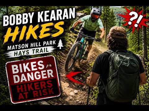
  • Matson Hill Park | Hays Homestead, Deer, & Dodging Mountain Bikes | Bobby Kearan Hikes

    Hiking Matson Hill Park in Saint Charles County, Missouri β€” one of the more scenic parks in the area, with some surprises along the way. I spotted deer, a rabbit, and the really cool old Hays Homestead ruins. I also got buzzed by speeding mountain bikers three times on what I thought was a shared…

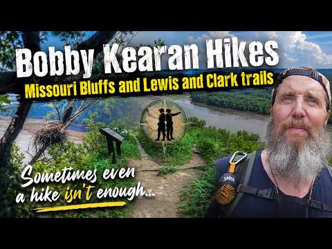
  • Missouri Bluffs & Lewis and Clark Trail β€” Eagles, Egrets, Lost Mic, and an Uncooperative Day.

    Some days the trail gives you everything. Some days it gives you an air show traffic jam, a dead GPS, a missing hiking stick, and a lapel mic that decided to bail. This was one of those days. And somehow, it still delivered. πŸ“ Missouri Bluffs Trail β€” Weldon Spring, MO πŸ“ Lewis and Clark…